TAt AVbimsoft, we specialize in transforming raw LiDAR point clouds into intelligently organized and classified datasets through our advanced LiDAR Classification Services. We meticulously identify and categorize each point, separating ground from vegetation, buildings from power lines, and vehicles from water bodies, revealing the true composition of your environment.
For Business Enquiry
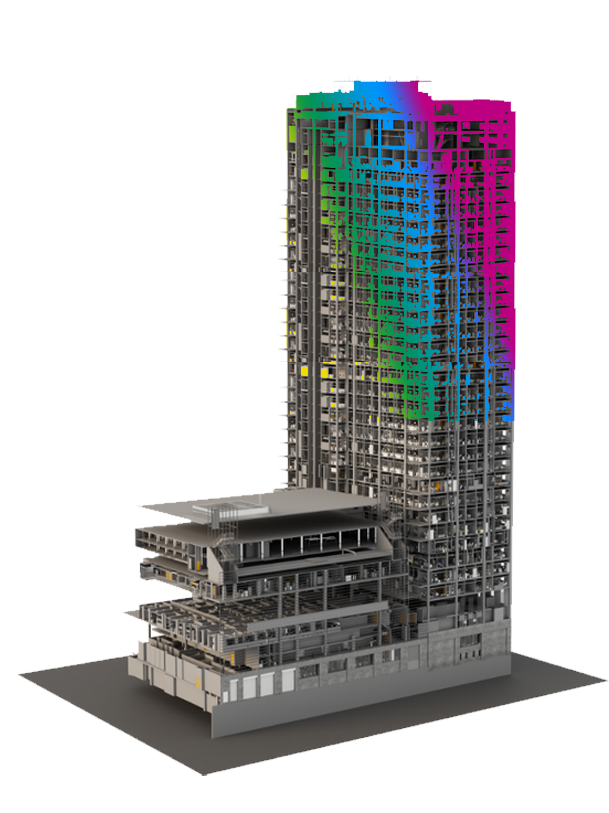
LiDAR (Light Detection and Ranging) technology delivers incredibly rich and detailed 3D point cloud data – a foundational element for accurate digital twins, intelligent models, and comprehensive mapping. However, raw point clouds are vast collections of points that, without proper organization, can be overwhelming and difficult to extract actionable insights from.
At AVbimsoft, we specialize in transforming raw LiDAR point clouds into intelligently organized and classified datasets through our advanced LiDAR Classification Services. We meticulously identify and categorize each point, separating ground from vegetation, buildings from power lines, and vehicles from water bodies, revealing the true composition of your environment.
Global Clients
Ongoing project
Reduction in Project Costs
Global Clients
Faster Project Delivery
Countried served
Our expertise ensures:

We convert complex point clouds into easily consumable, intelligent datasets that drive better decision-making.

Our skilled technicians and advanced algorithms ensure highly precise classification, capturing subtle distinctions within your data.

Classified point clouds dramatically improve the efficiency and accuracy of downstream applications like BIM modeling, GIS integration, and volumetric calculations.

Automating and streamlining the classification process reduces manual effort, accelerates project timelines, and optimizes resource allocation.

We tailor our classification approach to meet your specific project requirements, whether it's for forestry, urban planning, infrastructure mapping, or architectural analysis.

We provide classified point clouds in widely compatible formats (e.g., .LAS, .LAZ), ensuring seamless integration with your preferred software platforms.
but are not limited to
Separating ground points for accurate Digital Terrain Model (DTM) generation.
Differentiating low, medium, and high vegetation for forestry management, urban green space planning, and line-of-sight analysis.
Leverage the expertise of dedicated teams to accelerate the scanning and modeling process, leading to quicker project turnaround and delivery.
Isolating building footprints and structures for urban modeling, facility management, and architectural analysis.
Identifying power lines, poles, communication towers, bridges, and other critical infrastructure.
Classifying points related to rivers, lakes, and other aquatic features.
Distinguishing transportation networks for civil engineering and urban planning.
Cleaning raw point clouds to remove irrelevant data, enhancing overall data quality.
Why Choose AVBIMsoft Services?
Driven by a commitment to accuracy, efficiency, and innovation, AVBIMsoft takes a holistic approach to converting the physical world into a digital environment. Our use of advanced technologies ensures data precision, empowers smarter decision-making, and improves project workflows. The benefits of outsourcing AVBIMsoft services to us include:


Precise Solutions for Unmatched Project Results


LiDAR classification is the process of automatically or semi-automatically assigning specific categories or "classes" to individual points within a point cloud. This essential step turns a dense, undifferentiated mass of points into structured, intelligent data that can be used for precise analysis, 3D modeling, and feature extraction.